
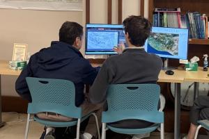
Current Research Projects
 |
Indigenous Histories in Guatemala From Fall 2023 to Spring 2024, students worked with W&M Anthropology Assistant Professor Sergio Palencia-Frener to map indigenous villages in the Maya Highlands of Guatemala. Through a combination of georeferencing 19th and 20th century surveys, GPS/GNSS points, and Google Earth, the team created a GIS dataset for these villages, which enabled Dr. Palencia-Frener to gather further ethno-cartographic information for the communities. In 2025-2026, publication-quality maps are being created for Professor Palencia-Frener’s upcoming book on indigenous histories in Guatemala during the Civil War in the 1960s through 1990s. The book focuses on rural indigenous communities and their movement through the country due to the war and violence |
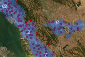 |
Network Analysis with the National Center for State Courts This group works with the National Center for State Courts, a non governmental organization that is an independent, non-profit organization focused on improving the administration of justice in the United States and around the world. Currently this team is analyzing public transportation networks in California counties to assess juror accessibility to courts they are summoned to. Using network analysis and a weighted distribution of random points, this project calculates travel times and costs of getting to a courthouse and if these factors could disproportionally impact different demographic groups. This research contributes towards evaluations considering what appropriate compensation is for jurors commute time. |
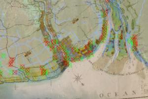 |
Historical Mapping in Guyana In collaboration with Dr. Catie Peters at the Omohundro Institute at W&M, this project is digitizing and georeferencing historic land parcels from a 1798 Dutch map to better understand the Black Land Movement in Post-Emancipation Guyana. The historical parcel information is being compared to modern day parcels in Georgetown, the capital of Guyana. |
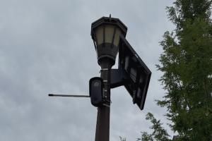 |
Flock Camera Locations in Virginia The Flock Camera project objective is to create a comprehensive dataset documenting the locations and jurisdictions of Flock ALPR Cameras (Automatic License Plate Recognition) in Virginia using open sourced data from Open Street map and publicly available Flock Transparency reports. The objective is to assess the potential privacy violations and concerns that arise from the surveillance presence of the Flock Cameras.
|
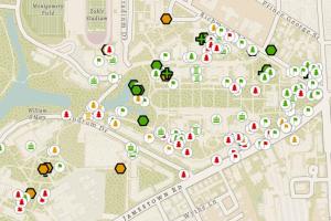 |
W&M GPS Mapping of Commemorative Elements The Commemoration team collects field data on commemorative objects on William & Mary’s campus. Commemorative objects are typically plaques or structures that memorialize outstanding alumni or significant contributions . Using GPS/GNSS devices, students document location, description, and condition to assist W&M Facilities and Risk Management in maintaining these items. The students are creating a geospatial dataset and an interactive map that allows interested parties to find any items that need to be repaired, updated, or replaced. |
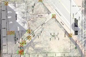 |
GIS Database Creation for Archeological Research WMCAR This project is supporting the work of the William & Mary Center for Archaeological Research (WMCAR) by georeferencing archaeological plans, including shovel test, test units, and utility lines. The digitization and preservation of these records ensures that WMCAR can better manage and document archaeological projects throughout campus and use this data to provide consultations and conduct future research at William & Mary. |
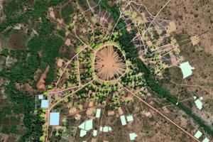 |
Satellite-based Indigenous Community Mapping, Brazil Since 2024, this team has been supporting the extended research of W&M Anthropology Professor Bill Fisher by creating community map features of the Kanela indigenous reserve in Brazil. Students use high resolution satellite imagery to digitize buildings, trails, and land parcels within the reserve to complement Dr. Fisher’s long term studies with spatial data. |
 |
W&M Campus LEED Mapping The goal of the LEED Project is to effectively communicate the efforts the university is taking towards sustainability. The project is compiling information on LEED building certifications and other initiatives such as geothermal wells to create an effective, accessible communication narrative online for public use. Through the creation of a comprehensive geospatial dataset of the LEED certified projects, an interactive AGOL Storymap with LEED sustainability scores will be produced. The project works closely with the W&M Architect and Communications team. |
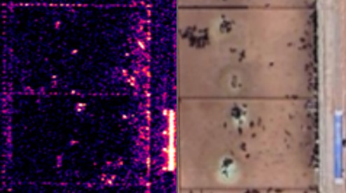 |
Radar Satellite Tracking of African Wildlife Migrations With a NASA-funded grant, this team is working with Dr. Jennifer Swenson (CGA & Data Science) to test very high resolution (VHR) synthetic aperture radar (SAR) commercial and public satellite products (NISAR, Sentinel 1) for their ability to identify large migrating animal herds in southern Africa. The goal is to design a workflow that can use these all-weather products to complement existing tracking methods (e.g. GPS collared animals) to better understand migration pathways, habitat use and to predict areas of potential human-wildlife conflict. |
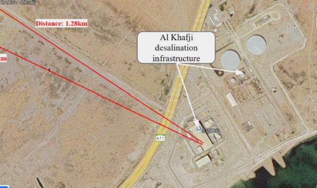 |
Geospatial Intelligence Research in collaboration with NGA This ongoing research group examines foreign policies and events across the globe with the support of high resolution VANTOR satellite imagery. The group, advised by Dr. Jennifer Swenson (CGA & Data Science) and partnering with the National Geospatial-Intelligence Agency, publishes papers on Tearline.mil, ‘a congressionally supported publication platform that features unclassified geospatial intelligence from academic and non-profit contributors using open research and commercial imagery. |
[]