
Post-baccalaureate GIS certificate program will start up this fall
Classes in William & Mary’s new certificate program in geospatial sciences will begin in the fall.
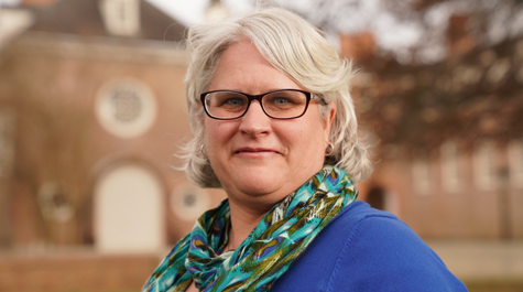
“It’s actually a certificate in Geographic Information Science, to be very specific,” said GIS Certificate Coordinator Shannon White. She added that the university’s Center for Geospatial Analysis will soon begin enrolling students in the 15-credit hour post-baccalaureate program.
The Certificate in Geographic Information Science was funded with seed money from Provost Michael Halleran’s Creative Adaptation Fund. The program recently received final approval from the State Council of Higher Education for Virginia (SCHEV).
White said students can enroll in the program part time or full time; full-time students should be able to complete the program in a year.
“It’s intended for a student who isn’t quite ready to go into graduate school or who maybe only took one GIS course because of their very packed undergraduate schedule,” White explained. “It also will be beneficial for a professional who has come across GIS as part of their job and they want to increase their knowledge.”
She said that the slate of courses leading to the certificate will deliver knowledge and skills using the latest relevant technology. The courses will cover geovisualization, cartographic design, remote sensing — acquisition of data by tools ranging from satellite to LIDAR— as well as deep dives into data analysis related to GIS, GPS, LiDAR and drone technology. As GIS tools have become more and more widespread and in demand by employers, the program also will address how the technical skills and knowledge are used in multidisciplinary contexts.
“Anyone who is interested in how space and place impact their work should think about this program,” White said. “The technology is a toolset that allows you to examine complex questions about the relationship of space and place.
“GIS is used in most every industry and profession,” White said. “So, if you’re coming from an urban-planning perspective, you’re looking at where the next building or the next commercial area should go. If you’re coming from a conservation perspective, you are looking at how to protect wildlife. How do we protect a species of plants?”
Members of the William & Mary community have been learning how to use the visualization of spatial data to do those things — and many others — for more than a decade. The Center for Geospatial Analysis was established as an interdisciplinary unit in 2008. The CGA has been offering formal courses to the university’s students and advising and collaborating with faculty from the humanities and social sciences as well as the natural and computational sciences.
Robert Rose, the director of the CGA, noted that the center has engaged in a number of community-based initiatives. One such collaboration was providing the interactive maps for FeedVa, showing levels of food insecurity in counties and municipalities throughout Virginia. The certificate program, based on the William & Mary campus, is the logical next step for the center.
“Most people think of GIS as just mapping,” White said. “But it’s much deeper than that. It gets into analysis and being able to answer questions and solve problems with the technology.”
She added that the certificate program could also be useful for experienced users who need to keep up with the ever-evolving state of the GIS art and science.
“The technology changes. Programming languages change,” White said. “Often, professionals want to earn certificates because it helps them increase their knowledge and they find that although they’ve been doing something every day, they can discover there is a new, more efficient way of doing it.”
She added that the CGA will begin workshops this summer designed to introduce GIS-savvy faculty to the newest software. Similar workshops will then be offered to area GIS professionals.
“They can come in and do a one-day introduction to the new ArcGIS Pro,” White explained. “A lot of people find it difficult to learn new software — they may not have time to do that on their own with people walking in and out of their offices all the time.”
Classes for the certificate program will be taught in the CGA’s lab on the second floor of Swem Library. A number of people have expressed interest in the program and White said many of them have asked if certificate classes will be offered on line.
“We want to make sure that we have a really solid set of courses that meet the needs of the students before we move it to an online environment, because it’s a highly technical space to be in,” she said.