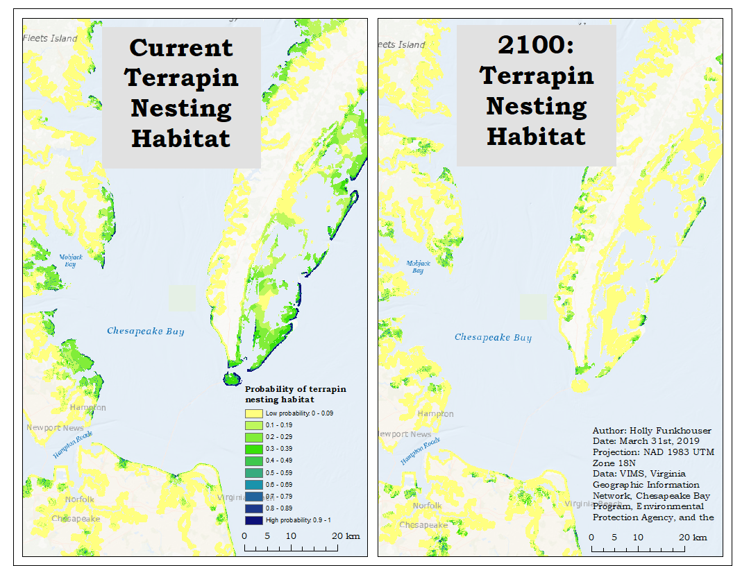
Diamondback Terrapin Nesting Habitats and Projected Sea Level Rise
Holly Funkhouser ’19
Diamondback terrapins are turtles that inhabit Virginia brackish waters of the Chesapeake Bay and the Eastern Shore. As a species reliant on optimal nesting sites on land, climate change and sea level rise will likely impact terrapin survival (Woodland et al. 2017). But where are those nesting sites in VA, and where will they shift with sea level rise? In parts of VA, “core habitat” for terrapin occupancy has been identified, but does not include nesting habitat. Our research examines how different environmental variables help describe current nesting habitat in Virginia. The goal is to use this information to predict how sea level rise will impact terrapin nesting habitat. We used ArcGIS to create the environmental layers and refine the sample data (terrapin nesting observations). The environmental layers consisted of metrics related to core habitat, salinity, beaches, and roads. The environmental data and the terrapin observations then went into a modeling program (Maximum Species Entropy Distribution Model) to create a map of diamondback terrapin nesting habitat in VA and projections of terrapin nesting habitat in 2030, 2050, 2075, and 2100.