
Catch the King catches Guinness World Record
Catch the King, a Hampton Roads citizen-science project for mapping high tides, is now officially a Guinness world record holder. The project's chief science liaison is Derek Loftis, an assistant research scientist at William & Mary's Virginia Institute of Marine Science.
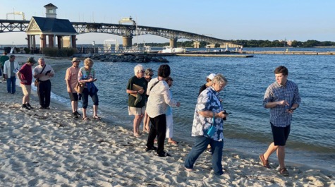
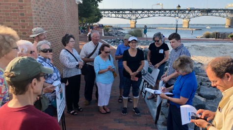
London-based Guinness World Records Ltd. announced this week that Catch the King’s debut event has earned a place in its book of accomplishments under the category of “most contributions to an environmental survey.” More than 700 Catch the King volunteers surveying a high tide on the morning of Nov. 5, 2017, collected a record-setting 59,718 measurements, according to the Guinness citation.
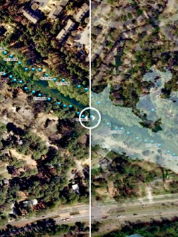
{{youtube:medium:left|3J9VtXM7hBQ, Learn how Dr. Derek Loftis uses data collected by volunteers during Catch the King events to validate VIMS' street-level flood model.}}
All that data-gathering helped improve a tidal flooding forecasting model developed at W&M's Virginia Institute of Marine Science. Catch the King also inspired a new flood mapping program launched last year by WHRO Public Media in more than 120 science classrooms across Hampton Roads. And Catch the King is becoming a springboard for citizen-science projects and art-science collaborations throughout the region.
Catch the King’s third-annual public mapping event is scheduled for high tide on the morning of Sunday Oct. 27, 2019. Organizers aim to have more than 1,000 citizen-scientists participating by 2020, some as part of new year-round mapping teams now being established.
As sea-level rise and tidal flooding increasingly threaten coastal Virginia, Catch the King offers residents a chance to crowdsource vital information about the tides’ reach.
Catch the King was launched by The Virginian-Pilot, the Daily Press, WHRO Public Media and WVEC-TV in conjunction with the nonprofit group Wetlands Watch and the Norfolk-based technology company Concursive Corp., whose “Sea Level Rise” app is used to measure tides. The project’s volunteer coordinator is Qaren Jacklich. Catch the King’s crown sponsor is the Hampton Roads Sanitation District.
{{youtube:medium:left|agP9qorZhlg, Learn all about the 2018 Catch the King event from the King himself in this video from WHRO.}}
Loftis and Jacklich are cited in the Guinness citation along with Concursive’s CEO, David Richards; Skip Stiles, the executive director of Wetlands Watch, and Dave Mayfield, a former Virginian-Pilot environmental reporter who conceived Catch the King and now serves as its lead volunteer.
More information on Catch the King, including volunteer opportunities, is available at whro.org/kingtide or by searching Facebook for “Catch the King.”