Taking a Closer Look: Evaluation
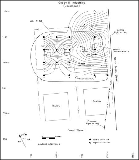 Once a survey has established that a site could be significant, the next step is to take a closer look. First we try to locate the most densely used (and thus more informative) parts of the site. This usually involves more closely spaced shovel tests. Information about the contents of each shovel test can be entered into a computer mapping program that pinpoints areas with high concentrations of artifacts. “Hot spots”are shown with closely spaced contour lines, similar to the way a topographic map shows steep slopes.
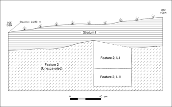
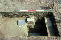
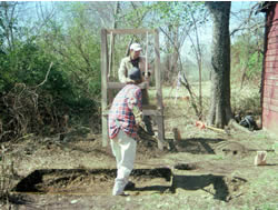
In areas of the site where shovel tests show high concentrations of artifacts, archaeologists open larger square excavations called test units usually 1 to 2 meters on a side). With more room to maneuver, the soil can be carefully peeled away, keeping artifacts from different layers separate. In these larger units, contrasting patterns of soil become apparent, indicating “features” or manmade disturbances such as pits, postholes, trenches, or privies. These excavations provide a representative sample of artifacts from different locations on the site, and allow a better view of the soil deposits.
These additional excavations, along with more detailed documentary research, provide enough information to decide if the site is significant. The larger sample of artifacts provides more refined dates and a better idea of who used the site and for what purpose: Slaves, wealthy farmers, industrial workers? As a residence, a store, a camp, a workshop? These are just a small sample of dozens of site types in Virginia. Clearer views of the site's stratigraphy and the discovery of archaeological features will show how much of the site survives intact. If the deposits are in good condition and the site type is of high research interest, the archaeologists will recommend preservation/avoidance of the site. Though always the first choice, sometimes avoidance is too costly or unfeasible. In that event, intensive “data recovery”excavations follow.