


Off the map
 Data projections Stuart Hamilton: "It's hard to predict the future, but I don't think we are going to return to an analog society. I think we are going to stay with digital and we'll have more data - and more spatial data, so we are going to need people who know how to manipulate that data." Photo by Stephen Salpukas
GIS data-stitching opens new research horizons
GIS is making new types of research possible at William & Mary. It's also allowing researchers to look at work in progress in new, compelling ways.
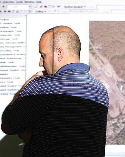
GIS uses computers to connect the dots among the often-neglected spatial components of data. The term itself is an acronym for "geographic information system." Rather than a single system, GIS refers to a variety of techniques and tools. Stuart Hamilton, director of the College's Center for Geospatial Analysis (CGA), says Google Earth and other data-rich, interactive features on the internet have made people familiar with the products of GIS, even if they're unfamiliar with the technology itself. In the past few years, researchers and scholars have discovered the world of GIS—and the world through GIS.
"Between 60 and 80 percent of all data collected has some spatial component," Hamilton said. "A lot of people weren't even looking at the spatial component of the data sets. Then GIS  came along and people found that it's applicable to not just geographers and geologists but also social scientists, education researchers, public-policy people and more."
A new home for the CGA
The William & Mary Center for Geospatial Analysis is settling into its new permanent location on the second floor of Swem Library. The birth of the CGA was made possible by a grant from the Andrew W. Mellon Foundation to the College's Environmental Science & Policy program. In addition to the Mellon grant, the center gets support from a number of other sources, including the Charles Center, Swem Library, Provost Michael Halleran and Dean of Arts & Sciences Carl Strikwerda. Gene Roche, from the College's Department of Informational Technology, made certain that the CGA had the technology it needed.
As the center gets support from a wide variety of sources, it provides support to a wide range of disciplines. The CGA itself dates to 2008, but Hamilton notes that individual programs and researchers at the College have been using GIS for years.
"It was ad hoc, here and there, without any real organization," Hamilton said of pre-CGA use of GIS. "You had some people in social sciences, like Professor Saporito, dipping their toe into GIS. You had the Center for Archaeological Research and the Center for Conservation Biology, using it on an as-needed basis. Geology and environmental studies hired adjuncts over the years to teach undergraduate courses."
Hamilton was referring to Salvatore Saporito, who worked with fellow sociologist Deenesh Sohoni to build GIS-driven maps showing the impact of magnet schools and private schools on the racial and economic integration of public schools. The W. M. Keck Environmental Field Lab also brought Tim Russell on as GIS technician; he taught classes in GIS software and contributed to a number of research projects.
SABINS moves in
The CGA has incorporated virtually all of the College's ongoing GIS work into its own operations. Russell is now the coordinator of the center's workshops. Saporito has literally moved into the CGA, after receiving a $1 million grant from the National Science Foundation to expand his GIS study of school boundaries into a more ambitious project called SABINS—the  School Attendance Boundary Information System.
Saporito is now working on the two-year SABINS project from office space in the CGA, with a staff that includes Ashwini Wakchaure, a GIS programmer; Jeff Han, senior spatial database engineer; and a number of William & Mary undergraduate researchers.
Both Hamilton and Saporito believe the establishment of the CGA at William & Mary was instrumental in bringing the million-dollar NSF grant to William & Mary. Hamilton says he expects the center to serve increasingly as a research hub for the College.
"A lot of granting institutions look very favorably on GIS technology," he said. "They're looking for proposals that offer a way to incorporate it into their curriculum and into their grants."
When Hamilton first arrived at William & Mary, he found that there was substantial pent-up demand for GIS services here.
"There were an awful lot of people waiting for someone like me to come to campus," he said. "There was a backlog of jobs waiting to be done, people who know what they want to do, but who don't possess the GIS skills or the tools to do it."
Some of Hamilton's first work, naturally enough, involved research done by faculty in Environmental Science and Policy, which had secured the Mellon grant that made the CGA possible. He introduced a GIS element into the studies of some graduate students who were working under biologist John Swaddle to understand the relationship between land use and the health of birds. He got involved early—and remains involved—with Dan Cristol's s-GIG investigation of mercury in songbirds of the Shenandoah Valley.
There are almost as many approaches to GIS tools and techniques as there are potential applications. Hamilton is a faculty member himself, and therefore often works as a collaborator, cited as a co-principal investigator on academic papers. In other instances, he is a teacher-trainer, imparting GIS skills and knowledge formally and informally. Researchers come to the CGA with all levels of experience, from absolute novices to long-time GIS users, such as Saporito. No matter the level of familiarity, all benefit.
"As far as faculty, Sal is the most skilled on campus. He's worked in areas in which he made the discoveries himself," Hamilton said. "He may even know more about the integration of census data with school data than almost anyone."
Still, Hamilton was able to show Saporito a new and more efficient way to solve problems, by using raster data rather than a vector data GIS approach.
More than one approach
"Sal didn't know much about raster data; he had to find a vector solution to his problems and it all could become quite convoluted. He came to me and I said, ‘Well, that's a raster problem. We can do that relatively simply'," Hamilton explained. "Sal was limited to a set of solutions, often the correct solutions, but sometimes they were very convoluted solutions.  With knowledge of only one data model, he had only a single path to go down. Now he's got a number of options."
Just as there is more than one way to approach a GIS problem, Hamilton says when it comes to addressing the GIS needs of each of the individual research projects at William & Mary, flexibility is the order of the day. Quite often, he says, he trains student researchers to use the necessary GIS techniques to apply to the research of their faculty mentors.
"There's no one way of working with people. It really depends on the scope of the project, what their needs are and what their levels of familiarity are," Hamilton said. "A lot of the faculty are just not going to have the time to learn the GIS concepts and then apply them in the software. So it's good to work through their students and have students that become skilled and can do the GIS for them—or teach the faculty how to do it."
Outside the entrance to the CGA facility in Swem stands a display dedicated to GIS-based research. There are academic papers on the effects of Central American shrimp farms, real estate price change and a number of others. Hamilton says even he is surprised by the breadth of applications for GIS techniques.
"I'm always amazed by uses coming up that I don't expect," he said. 
