


A new state park incorporates a pre-Jamestown outlook in its design
 Modern yihakan: A 21st century take on the yihakan, the traditional Algonquian longhouse, grounds the interpretive peninsula at Machicomoco State Park. William & Mary anthropology Professor Martin Gallivan was a consultant in the design of the park, Virginia’s newest. Courtesy photo
Before there was Machicomoco State Park, there was Cappahosic.
In fact, since the park sits on what is likely the same land, Martin Gallivan wanted Virginia’s newest state park near Gloucester to bear the name.
“Cappahosic was a fairly sizeable community for an Algonquian town,” Gallivan said. But state park officials pointed out that there is an existing, modern community located upstream, also called Cappahosic. To avoid confusion, the park was dubbed with the Algonquian word meaning 'special meeting place.'”
 Gallivan, professor and chair of William & Mary’s Department of Anthropology, says he’s perfectly happy with the Machicomoco name. He’s even happier with how the park turned out, as he was a consultant in the design.
“It's a really innovative design,” Gallivan said. “The space is different than any other state park you've been in. It’s different than any other national park you've been in. It subtly and creatively immerses you in a Native landscape in a way that I don't think any other place around here does.”
Gallivan is the author of The Powhatan Landscape: An Archaeological History of the Algonquian Chesapeake, and has conducted numerous archaeological examinations of the riverine Native communities, of which Cappahosic was just one. He said Cappahosic was one of the minor Powhatan communities.
“This wasn’t a big town,” he said. “But it was part of a network of Native communities where people knew each other, traded with one another, and married each other.”
When the Jamestown colonists arrived, the center of power was at chief Powhatan’s capital of Werowocomoco, 10 or so miles up the York River from Cappahosic. Gallivan said that in the Powhatan’s hierarchy of government, Cappahosic was likely in the orbit of Kiskiak, a larger community “just a short canoe paddle across the York River, or what would have been called the Pamunkey River back then.” The land occupied by Kiskiak is now part of the Naval Weapons Station complex.
Cappahosic even has a prominent place in John Smith’s accounts of his parleys with Powhatan during the early days of the Jamestown colony.
“After Smith was captured and brought to Werowocomoco, Powhatan said, ‘OK, now you are one of my people, and I want your community to relocate to Cappahosic,’” Gallivan said. “I suspect Powhatan wanted to keep an eye on the English. Ten miles downstream is far enough away that you’re not really close neighbors, but close enough to keep an eye on them. You know the saying: Keep your friends close, and your enemies closer?”
Of course, Smith and the other English colonists stayed in Jamestown, leaving Cappahosic to the Powhatans. Gallivan said his work with the Charlottesville landscape architecture firm Nelson Byrd Woltz began by imagining what Cappahosic must have looked like back in the day. The landscape architects developed the initial park design and invited Gallivan to join the team as they made plans to consult with contemporary tribal communities in Virginia. The design team was able to look out on a riverscape that is surprisingly unchanged from the Powhatan era, even after more than a quarter of a millennium.
“You would have seen a number of Native houses on the bluff overlooking these wetlands and creeks,” he said. “On the floodplain beneath where the houses are on the bluff, you’d see a series of corn, beans and squash fields — the three sisters. You’d see people fishing on the river, people making tools, people preparing food.”
Accordingly, Gallivan and the Nelson Byrd Woltz designers placed a modern take on the “yihakan,” atop the bluff, where the yihakans of the Cappahosic residents once stood.
“It’s probably a little bit too wide, but the length is close to right,” Gallivan said.
The yihakan is centered on what Gallivan calls an “interpretive peninsula” that dominates its section of Machicomoco. He said visitors can go out on the peninsula and can experience a view completely familiar to a 17th century Powhatan werowance.
“You can see the river, with the Catlett Islands in the distance,” he said. “Visually, it looks much like the landscape before 1607. Low tide exposes large oyster reefs just offshore, much as they would have appeared 400 years ago.”
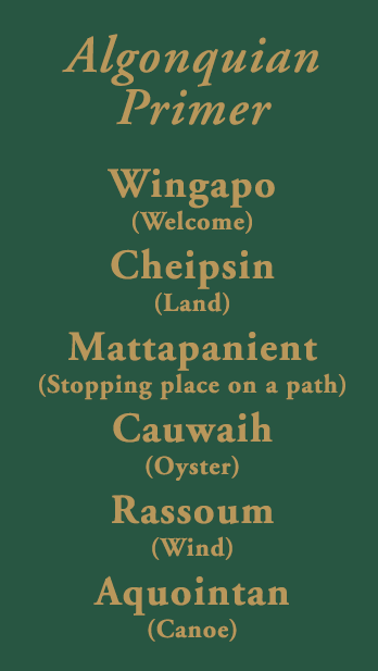
To enhance the experience, the designers strategically placed what Gallivan calls “Easter eggs” throughout the peninsula — translations of Algonquian words for important natural elements such as plants, animals, the sky or various aspects of the river.
“The idea is for you to see how the space would have been experienced by Native peoples through the lens of Algonquian terms,” he said.
A timeline of the site is embedded in the floor of the hakan The yihakan also holds six didactic panels featuring text written by Gallivan.
“I don’t know if anybody’s going to read all of that text; there’s a lot there,” he said. “But I tried to convey different aspects of the Native past and the Native present in an understandable way.”
In fact, what Gallivan called the “Native past and Native present” was a large part of the planning and design of Machicomoco State Park. He said archaeological evidence suggests that there were people living at or very near the state park some 10,000 years ago.
“It’s complicated to think about whether that same community that existed 10,000 years ago was related to the community that the Jamestown colonists interacted with,” he said. “But there is a connection. The archaeological record points a line of continuous presence across that region.”
A number of existing tribes have a connection to the land the state park now occupies: the Chickahominy, Eastern Chickahominy, Mattaponi, Upper Mattaponi, Monacan, Nansemond, Nottoway, Cheroenhaka Nottoway, Pamunkey, Patawomeck and Rappahannock. Gallivan said the tribal voices were important in the design and development of Machicomoco.
“We held a series of workshops with Virginia’s tribal communities. We talked to all 11 tribal communities —the federally recognized tribes and the state recognized tribes —and received really useful input from them on what the park should look like,” he said.
The tribal members even provided the park’s name, Machicomico. The tribal consultants had three main priorities: First, to make sure the park is designed to depict the space as a fundamentally native landscape.
“That’s something that they really wanted to do,” Gallivan said. “Number two, they wanted us to highlight the deep history of Native people in the region, to get across the idea that they’ve always been there, and they have a long and complicated history of placemaking.”
And finally, Gallivan said, the tribal members want to emphasize the persistence of the Native communities: “That they’re still here today and will be here into the future.”