


GIS Day competition & ‘Mappy Thanksgiving’ from the Center for Geospatial Analysis
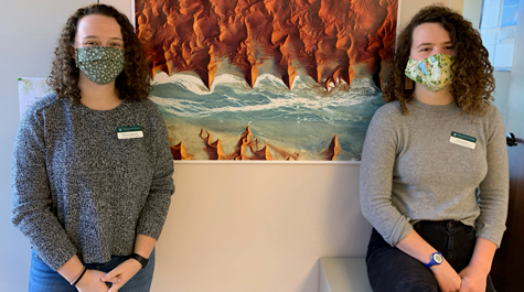 CGA Fellows: Olivia Spencer (left) and Ella Kasten put together a slate of activities that managed to merge international GIS Day and Thanksgiving. Courtesy photo
Versatile and interactive, the GIS-driven storymap may become the quintessential communication medium of the 21st century.
“It’s a user-friendly application that people can use to embed maps, images, videos, text,” explained Olivia Spencer. “It’s a really interesting way for people who aren’t super-knowledgeable in GIS and software to tell a story using spatial data.”
Spencer ’20 and Ella Kasten ’20 are fellows at William & Mary’s Center for Geospatial Analysis, a facility that teaches the university community the basics of mapping and spatial analysis, known collectively as GIS or geographic information systems. As part of the CGA’s participation in the international GIS Day on Nov. 18, Spencer and Kasten decided to challenge William & Mary students to a storymap competition. Once the entries were all in, it was hard for Spencer and Kasten to pick a winner.
“This was a hard decision for us to make,” Spencer said. “We created a rubric where we scored each story map based on flow of a story, visual engagement, content and relevance to the theme. And our theme was diversity, inclusion and accessibility. After we scored all the StoryMaps, we actually had a tie.”
They brought in another CGA staff member to break the tie in favor of an entry from Grace Elman ’20. Elman’s storymap, The Fight for Accessibility, traces the history of activism that led up to the signing of the Americans with Disabilities Act 30 years ago.
“Grace’s entry really hit all of the points,” Kasten said. “Her story is visually engaging and uses maps to bring the user in. She was spot-on with the theme; she’s talking about accessibility.”
Honorable Mention went to The Life and Legacy of Dr. Sylvia Earle, by Sydney Fuhrig ’21 and Natalie Spage ’23.
Kasten explained that a storymap competition made sense in a number of ways. For one thing, GIS Day just happens to fall as William & Mary classes end, therefore students in various GIS-enriched classes would have class projects to enter. Also, the software empowers even GIS beginners to turn out impressive work.
“It’s a great way for people to dip their toe in the water of GIS,” she said. “You can generate templates pretty easily. The way the software is designed, you can make a really polished finished product really easily. And that’s why we like storymaps — because they look really good without too much effort from the user.”
Spencer added that another reason to like storymaps has to do with the interactive capabilities of the medium. The storymap experience is not necessarily linear. A viewer can read text, click through images and engage with maps.
“You can zoom in and out on the maps — move around on them,” Spencer said. “I think a nice balance between that interactive component where the user can click around and the elements that guide the user through the story itself, that’s what makes a good storymap.”
In addition to the competition, Spencer and Kasten created a storymap of their own to celebrate GIS Day virtually. They noted that GIS Day was quite close to both Thanksgiving and the end of the undergraduate fall semester, making it a great time to celebrate and give thanks.
“We were talking a few weeks ago about how happy we were that this semester was such a success,” Spencer said. “We asked ourselves what could the CGA do as to show the community our gratitude and provide an outlet for students and faculty to also share what they’re thankful for.”
They created a Campus Gratitude Map, headlined “Mappy Thanksgiving.” It’s a standard map of campus and environs liberally marked with W&M-appropriate green and gold pins.
“There are two different layers in the map,” Kasten explained. “The gold pins are the submissions from individuals. We also created a layer of green pins just to make sure everyone on campus got thanked.”
She said that she and Spencer populated the green-pin layer by checking, building by building, the location of each department and unit.
“So everyone is thanked in the green layer,” Kasten said. “And there’s a different layer of gold pins for individual expressions.”
The Campus Gratitude Map has been well received; Kasten said it’s logged 670 views as of Nov. 19. They expect more views and more gold-pin expressions of individual gratitude as exams end.
The CGA fellows’ additions of the storymap competition and “Mappy Thanksgiving” went a long way toward improving international GIS Day observances at William & Mary during a time of physical distancing and PPE. Spencer and Kasten added other activities, such as a GIS jigsaw puzzle, a scavenger hunt, a round of GeoGuesser and a remote imagery identification test.
“It was really good,” Kasten said. “So it may not be the GIS Day that the CGA is used to hosting, but I think we made pretty good use of the virtual world to celebrate.”
