


This summer, the mercury rose on Lake Matoaka
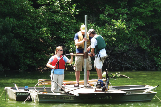 Drilling platform A couple of jonboats lashed together make a stable coring platform for Caitlin Dronfield ’10, geologist Jim Kaste and Randy Chambers, director of the Keck Lab. The three researchers cored into the bottom of Lake Matoaka in summer of 2009. Photo by Tim Russell
Before Lake Matoaka, there was Ludwell’s Millpond. Before that, it was a cypress wetland that the colonists dubbed Archer’s Hope Swamp.
One hot July day, Randy Chambers, Jim Kaste and Caitlin Dronfield went out on the lake to delve down through the waters and into the bottom, coring down through the Lake Matoaka bottom, past the Ludwell’s Millpond layers and into the regions representing the pre-1720 era, when the lake was a cypress swamp.
They did it twice, once about 100 meters off the Keck Lab dock and another time near Squirrel Point. They came back to the lab with a pair of cores two meters long, representing the bottom of Lake Matoaka from 2009 through prehistory. Kaste is an assistant professor of geology at William & 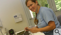 Mary; Chambers is the director of the W.M. Keck Field Laboratory and the Talbot Professor of Biology. Dronfield is a geology major in the class of 2010. They’re collaborating on an environmental study of Lake Matoaka and its watershed, currently concentrating on mercury deposits through the decades. The cores were halved lengthwise and laid out on a table in the Keck Lab for examination.
“I think I’ve got a piece of Pocahontas’s charcoal,” said Dronfield, smiling as she uses a plastic spoon to tease out a small black chunk from the old end of the core. She will spend much of her senior year doing analysis on the historical trend of mercury deposits in the sediment.
Working with Kaste, a specialist in heavy-metal deposits in soils, Dronfield will use cold vapor atomic absorption spectrometry to determine how much mercury is in each layer of the core. Kaste explained that the researchers can date each layer by using natural and anthropogenic radioactive tracers.
“This also will allow us to determine quantitatively when heavy metal deposition from the atmosphere began in the region. By that I mean mercury, lead and so forth delivered via rain,” Kaste said. “We’re using (biologist) Dan Cristol’s lab for the mercury measurements.”
Chambers said the cypress swamp was flooded to make the millpond in the 1720s, an event clearly visible in the abrupt transition in color and texture in the sediment. The pre-dam section of the core is readily apparent, with its darker, grainer texture, spotted with large chunks. For the researchers, the most interesting aspects will come out of analysis.
“Previous studies have shown that there was a spike in mercury in the 1970s and an increasing trend from then on,” Dronfield said. She said the project will go on to examine how much mercury comes in from each of the various tributary streams of Lake Matoaka. 
