Archaeological Distribution Maps
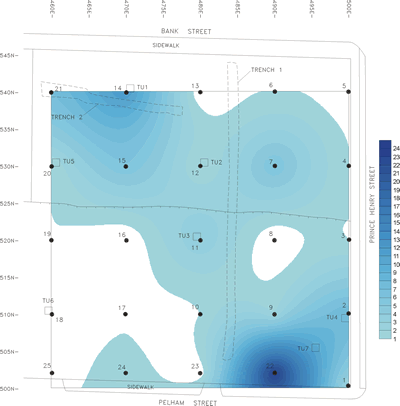
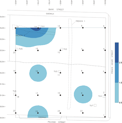
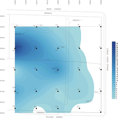
The darker shading on these maps of the Prince Henry Avenue site shows where various types of artifacts were most heavily concentrated. Total numbers of artifacts from shovel tests and their locations on the site grid were entered into a computer mapping program that generated these “distribution plots.” From the top, the maps show the distribution of prehistoric artifacts, colonial ceramics, and post-colonial ceramics. Based on this information from early shovel testing stage of the excavation, the archaeologists decided where to place larger test units.