
Rob Rose spreads geoscience gospel from his pulpit at the CGA
Rob Rose is William & Mary’s new Geographic Information Systems (GIS) evangelist, spreading the gospel of geographic information systems among students and faculty alike.
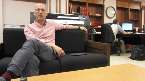
Rose has been the director of the university’s Center for Geospatial Analysis since July. The CGA is headquartered on the second floor of Swem Library, where it was established in 2008.
The center joined geospatially-minded people across the world in the celebration of GIS Day on Nov. 18, offering a full day of activities. A pair of morning Introduction to GIS workshops was followed by a set of 10-minute “lightning talks” on geospatial subjects.
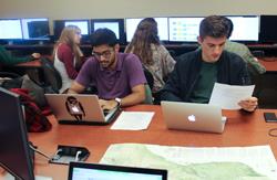
An evening “mapathon” capped GIS Day. Rose said that two students, Hannah Dempsey ’16 and Lu Sevier ’16 organized the event. He explained that mapathon participants used an open-access tool called OpenStreetMap, which is developing a fine-scale map of the world through crowdsourcing.
“This means people sitting down at computers with aerial photos and just basically mapping out different resources,” Rose explained. “The students organized a project to connect to the recent earthquake in Afghanistan. They want to provide some support in the form of mapping resources that would help the recovery. So basically, we had a room full of students using OpenStreetMap on our computers or on their laptops, digitizing features for Afghanistan.”
The mapathon is a good example of GIS capability, Rose said, but GIS goes far beyond OpenStreetMap or any one project, product or app. Rather, GIS is a collection of tools, techniques and concepts that can be used in just about any context that relies on data.
“GIS is pretty broadly applicable,” Rose said. “You name me a discipline and I could name an application of GIS for it. Even in the arts and literature — the disciplines that aren’t really associated with geospatial resources. We’re reaching out and figuring a way to connect with those disciplines.
 The CGA serves the geoscience needs of William & Mary’s students, faculty and staff. Rose said that the center offers a slate of courses on aspects of geodata use, including the increasingly popular Introduction to GIS class. He said the level of familiarity with the tools and possibilities among the students in the intro class ranges widely.
“You have students who have never even heard of GIS before and it’s brand new to them,” he said. “But you also have students who have worked for AidData.”
AidData is a collaborative research initiative, based at William & Mary, that collects and publishes data on trillions of dollars in international aid. It makes extensive use of geocoding and other GIS concepts, and also involves many students, as well as faculty.
“AidData is a great place to learn GIS,” Rose said. “They’re teaching a lot of students how to use GIS. We’re getting some of those students into the class, and they’re more experienced in terms of the use of these tools.”
The course material matches the broad range of GIS familiarity among William & Mary undergraduates. Rose said that while a newcomer can take the course for the basics, there’s enough substance that a relatively GIS-savvy student also can benefit, “and hopefully get more enthusiastic about using these tools.”
Rose is working to expand William & Mary’s GIS by adding another course to the duo of Intro to GIS and Introduction to Remote Sensing, both of which are part of the Arts & Sciences COLL Curriculum. He said he would like the new course to present GIS on a conceptual level.
“It will give students an introduction to geodata and geosciences without having the heavy lift of learning new software,” Rose explained. “The idea would be that every week or two weeks, you’d have a discipline-specific lecture where you would see how that discipline is answering questions by using spatial data, and then they would have some hands-on activities to actually use those data in a simplified fashion to answer some of those questions.”
The other part of the CGA’s geospatial evangelism, beyond the formal courses, is serving as a consultant and collaborator to faculty, staff and students who want to use the power of GIS to enhance their project. GIS offers a variety of tools, approaches and concepts and Rose explained that a researcher new to GIS should begin the approach to geodata with a conversation at the CGA.
“We would first talk about the types of questions you’re trying to answer,” he said. “I’ve talked to archaeologists, for instance. They’re trying to understand historic routes from one location to another. They want to know if we could potentially model those routes using GIS. And I say, yeah. That’s the kind of question that specifically embraces geospatial analysis.”
After the researcher and the CGA staffer have framed the questions, Rose said, the discussion should turn to what sort of data are necessary and what types of analyses will be needed. Last, but not least, you’ll need to decide how to present the results.
“I think that final step is important,” Rose said. “Maybe you’re making a map or an online resource that engages maps and spatial data that presents results.”
The first step, the discussion of the project is easy, he added, and requires very little from the researcher.
“You need an idea. That’s all,” he said. “That’s how we see our role in the CGA — taking an idea and taking it through the GIS process.”