


William & Mary launches GIS certificate program in DC
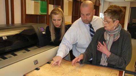 Creative adaptation Stuart Hamilton, director of the Center for Geospatial Analysis, works on a mapping project with Cassie Prena '12 and Barbara Watkinson, professor of art history. Hamilton and John Swaddle have begun accepting applications for the College's new certificate program in Geographic Information Science for summer 2013. Photo by Joseph McClain
Just three months after being awarded a grant from the Provost’s Creative Adaptation Fund, William & Mary Professors John Swaddle and Stuart Hamilton have begun accepting applications for the College’s new certificate program in Geographic Information Science (GIS) for summer 2013.
Based in the W&M Washington Office, the GIS post-baccalaureate program will offer a series of graduate classes targeted to working professionals in the D.C. area who use GIS in their employment. GIS is a collection of techniques that allow data to be mapped and analyzed. It is a powerful and versatile approach that is used by researchers in the natural sciences, the social sciences and the humanities.
“I’m so pleased to see this investment from Creative Adaptation Fund bearing fruit so quickly,” said William & Mary Provost Michael R. Halleran, “and particularly in D.C. where the College has so many opportunities to grow. GIS is a cutting-edge discipline that a wide variety of organizations are now using to advance their missions. This is an exciting step for the College.”
The program has a focus on analytical cartography and spatial analysis with a particular emphasis on policy relevant international databases such as the AidData international aid database and the social conflict in Africa database. In keeping with the W&M tradition, courses will be taught in a small group setting with a focus on faculty/student mentoring and contact.
Starting July 1, 2013, the first course “Fundamentals of GIS” will be taught in the W&M Washington Office by Professor Stu Hamilton of the W&M Center for Geospatial Analysis, in consultation with Dean of Graduate Studies and Biology Professor John Swaddle.
“D.C. is one of the global hubs of GIS expertise and William & Mary already has a strong GIS presence in many D.C. institutions. The new GIS program will build on the these relationships by offering quality GIS instruction in a small group setting merging the best qualities of William & Mary with the drive and capacity of the DC GIS community,” said Hamilton.
Students will typically complete the program in one or two summer sessions. All classes are offered outside of regular work hours.
More details about the program and an online application can be found at the W&M GIS program website.
