


2002: GPS Survey of Campus Trails
Ryan McKinney (Geology)
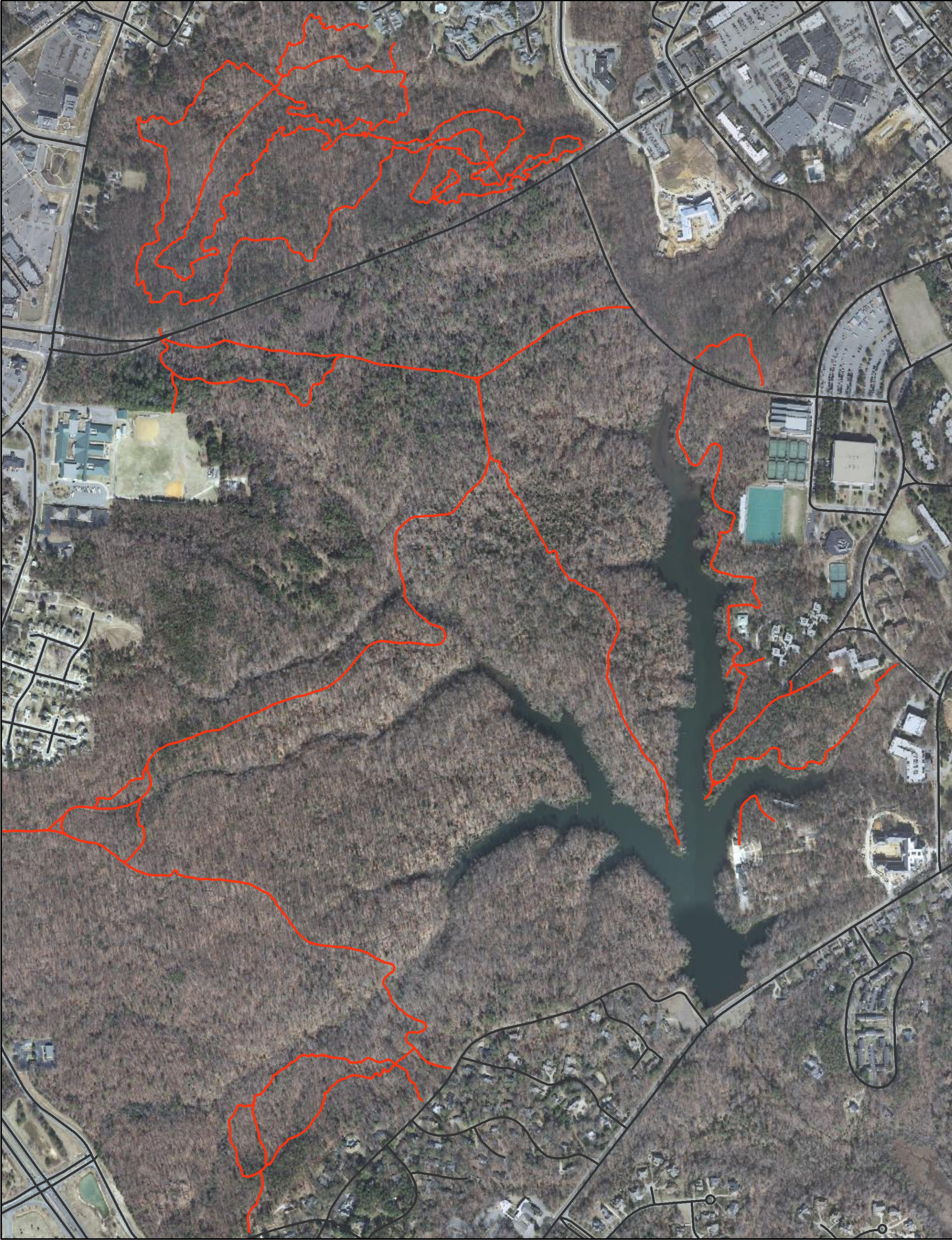
Over the last year, Ryan McKinney conducted an in-depth investigation of the factors that influence trail conditions in the College Woods. This was the topic for his Senior Research Presentation. Per Board of Visitors Resolution #7 (February 1994), the area comprising Lake Matoaka and the College Woods south of Monticello Avenue (South College Woods) has been designated a natural preserve. The College Woods north of Monticello Avenue is used primarily for recreation. The Civilian Conservation Corps developed a majority of the trails around Lake Matoaka in the early 1930's. Since that time little has been done to maintain the trails. McKinney's goal was to identify negative environmental and human-induced factors in an effort to develop a remediation plan. He constructed a detailed map of the College Woods Trail System to identify deteriorated sections of trail, trail slope, trail geology, and trail use. He identified a slope of greater than 10 degrees and precipitation as the most significant environmental threats to trail quality. Ongoing trail use, unapproved trail construction, and a lack of maintenance on original trails are the most significant human induced threats.
Additional documentation includes a Trail Degradation presentation, Previous Work , Trail Shp File (GIS) and a Final Paper.
Map of Trails in Matoaka Woods
